Why it’s extraordinary
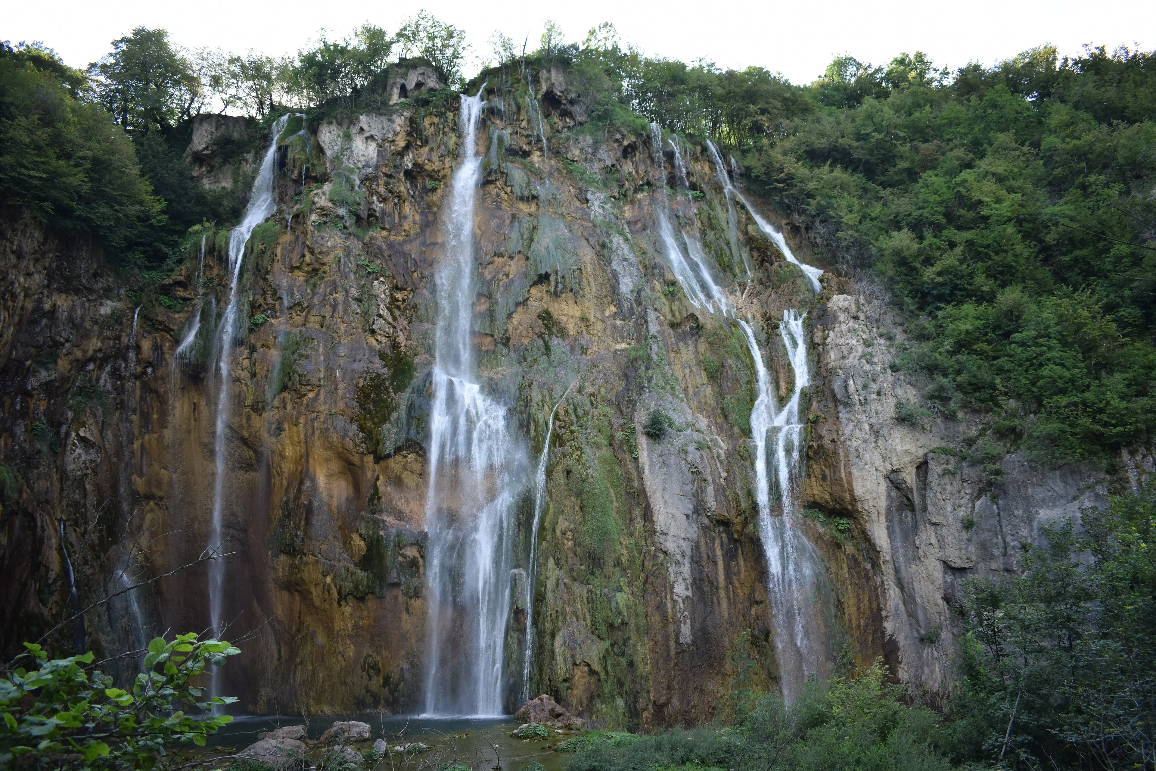
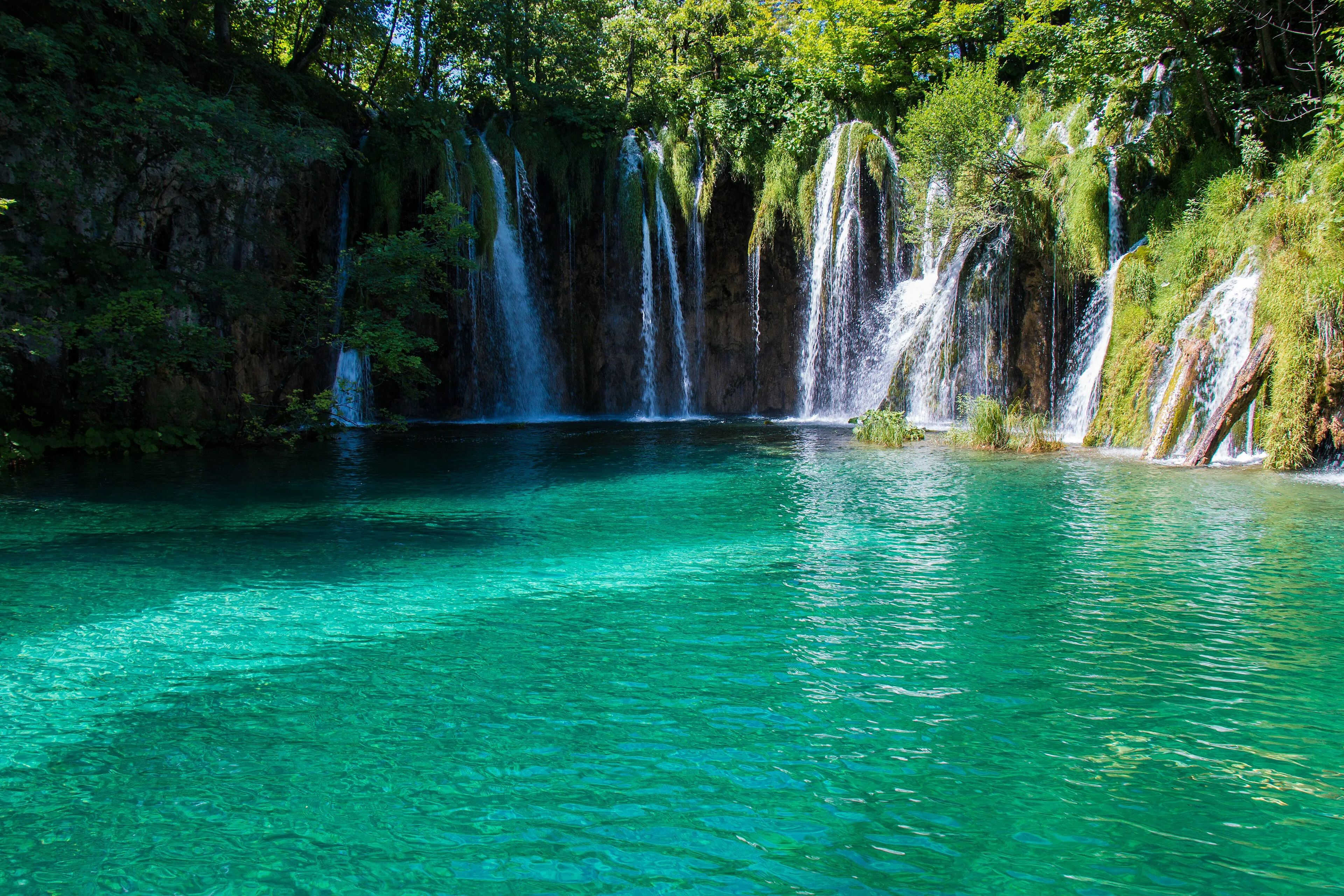
Plitvice is not a set of lakes that happens to have waterfalls. It is a single system that is still building itself. The water running through this karst country carries so much dissolved calcium carbonate that, under the right conditions, it drops it again — on lake beds, on fallen branches, on the mosses and algae living in the current. Layer by layer, those deposits harden into tufa: porous, surprisingly fragile barriers that hold back one lake above the next.
The result is a staircase. The upper lakes sit on dolomite among gentle, forested shores; the lower lakes lie in a steeper limestone canyon. Water spills from one to the other over barriers it built itself, which is why UNESCO describes the park as a landscape shaped by processes that continue today.
A forest that keeps the water clear
The lakes depend on the woods around them. Most of the park is well-preserved forest, including 84 hectares of old-growth beech and fir, and UNESCO ties that forest cover directly to the water chemistry that keeps tufa forming. The same forests shelter brown bears, grey wolves and lynx.
Visiting responsibly
Popularity is the park’s biggest pressure. UNESCO flags heavy visitation and wastewater as real risks to a system that depends on exceptionally clean water. The park’s own rules reflect that: no swimming, no leaving the boardwalks and marked paths, no drones. Following them isn’t a formality here — it protects the barriers that make the lakes possible.
Reading the landscape
Once you know what tufa is, the park reads differently. The upper lakes sit on dolomite, with gentler, wooded shores; the lower lakes fill a narrower limestone canyon with steeper walls. Look at the lips of the cascades and you are looking at the barriers themselves — moss-covered, porous and growing. That fragility is why the boardwalks exist, and why the park asks visitors not to step off them.
Planning notes
The park has two main entrances about 3 km apart, each with its own set of signed routes. The shortest official circuit (Programme A, from Entrance 1) takes in the Great Waterfall in roughly 2–3 hours. The park never closes, but its hours and services shrink in the colder months, when most hospitality facilities shut. We don’t list ticket prices here; check the official park website before you go.
Verified practical notes
- Entrances: Entrance 1 (north) 44°54′17.9″N 15°36′40.3″E; Entrance 2 (south) 44°52′58.5″N 15°37′25.2″E — about 3 km apart, both on state road D429 (Plitvice Lakes National Park (official), checked 2026-10-16)
- Shortest official route: Programme A from Entrance 1: circular, about 3,500 m, 2–3 hours, past the Great Waterfall (Veliki slap) — the largest waterfall in the park and in Croatia (Plitvice Lakes National Park (official), checked 2026-10-16)
- Park rules: No swimming, no leaving marked footpaths, no cycling, no feeding animals, dogs on leash, and remotely controlled aircraft (drones) are banned (Plitvice Lakes National Park (official), checked 2026-10-16)
When to go
- Open all year: The national park is open 365 days a year, but its opening hours change with the season (Plitvice Lakes National Park (official))
- Colder months: During the colder part of the year most hospitality facilities close, and Hotel Jezero is the only accommodation open inside the park (Plitvice Lakes National Park (official))
- Hours on 16 Oct 2026: Entrances 1 and 2 open 07:00–18:00, ticket sales until 15:00; electric boats and panoramic vehicles run on timetables — check the live page before you go (Plitvice Lakes National Park (official))
Share this place
Sources
- UNESCO World Heritage Centre — Plitvice Lakes National Park — accessed 2026-10-16
- Plitvice Lakes National Park — official visitor information — accessed 2026-10-16
- Wikipedia — Plitvice Lakes National Park (coordinates only) — accessed 2026-10-16
Last verified 2026-10-16 · Written by WonderAtlas Editors. Original editorial text; no first-hand visit is claimed. How we work.