Why it’s extraordinary
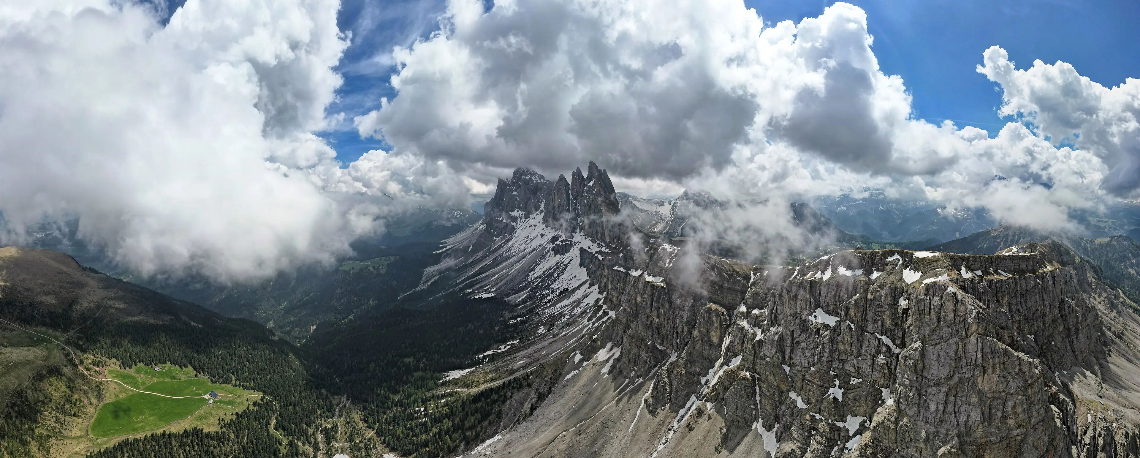
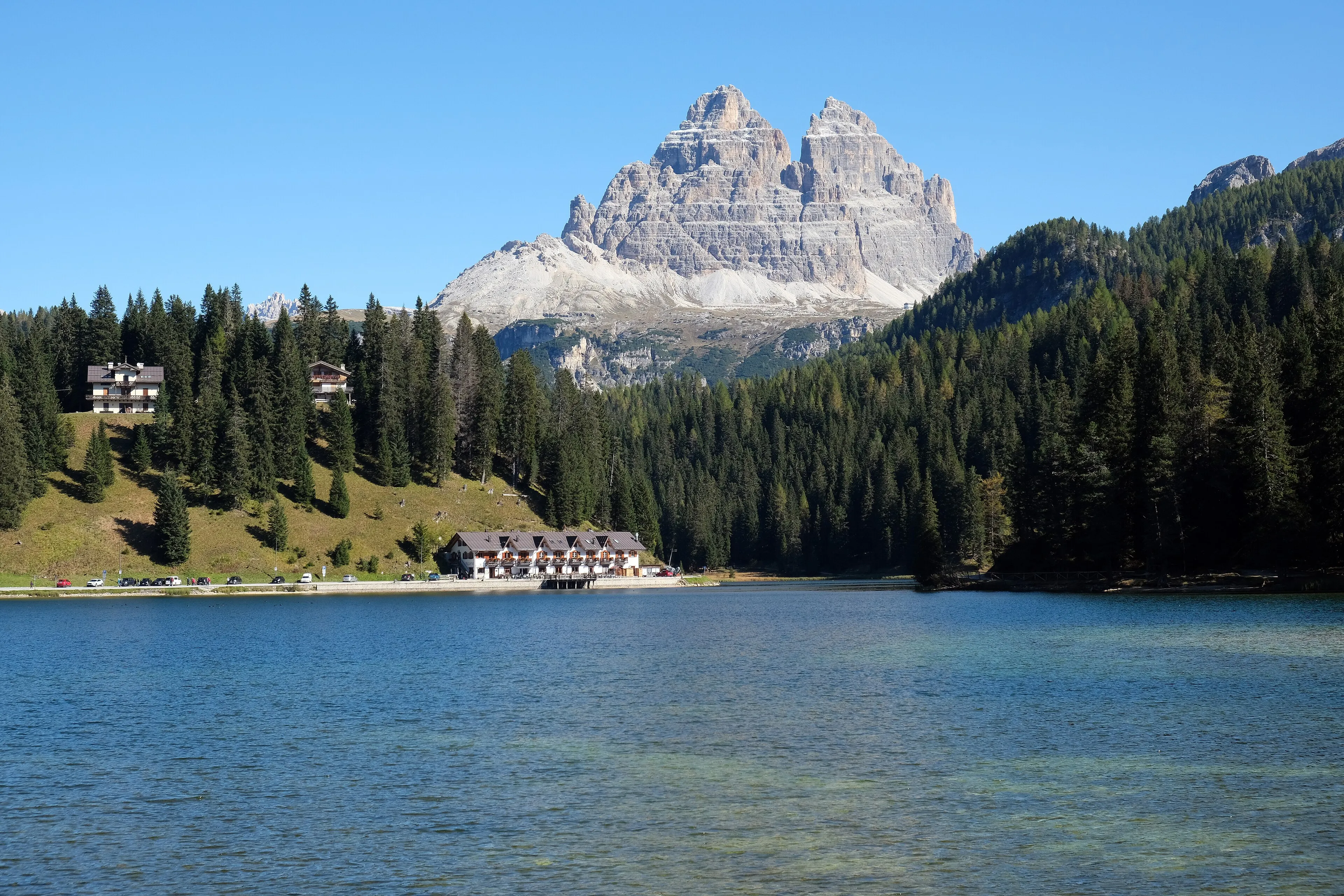
Most mountain ranges are remembered for a single summit. The Dolomites are remembered for a shape: sheer, pale towers and spires standing straight out of soft green slopes, with ledges and plateaus cutting horizontal lines across the verticals. UNESCO’s evaluation goes as far as calling this the archetype of a “dolomitic landscape” — the reference point against which similar mountains elsewhere are described.
That look is not decoration on top of the geology; it is the geology. The rock here is largely limestone and dolomite laid down in warm Triassic seas, and parts of the range preserve the outlines of ancient reef-built platforms — effectively fossil atolls — alongside the basins that once surrounded them. For earth scientists, these exposures document how marine life rebuilt itself after the largest extinction event in the planet’s record.
How the range is organised
The World Heritage property is not one continuous park. It is a set of nine separate mountain systems, managed jointly across five Italian provinces. That matters for travellers: “visiting the Dolomites” can mean very different valleys, trailheads and road passes, and the nine-system map published by the Dolomites UNESCO Foundation is the most reliable way to orient yourself before choosing a base.
Looking closer
- The verticals. Some walls rise more than 1,500 metres — among the tallest limestone faces anywhere.
- The colour shifts. UNESCO highlights the contrast between bare pale rock and the forests and meadows below; that contrast is the reason the range photographs so differently through the day.
- The stories in stone. Several sections serve as internationally important reference sections for Triassic stratigraphy — the rock layers themselves are a textbook.
Choosing an area
The Dolomites UNESCO Foundation names the nine systems as Pelmo–Croda da Lago; Marmolada; Pale di San Martino, San Lucano, Dolomiti Bellunesi and Vette Feltrine; the Friulian Dolomites and d’Oltre Piave; the Northern Dolomites; Puez–Odle; Sciliar–Catinaccio–Latemar; Bletterbach; and the Brenta Dolomites. They differ in size and character, so it’s worth reading the foundation’s description of each system before you choose a base. Picking one or two systems — instead of trying to “see the Dolomites” in a single sweep — usually makes for a calmer, better trip.
Planning notes
We are still verifying season-by-season guidance (lift operating periods, pass road openings and trail conditions) against official sources. Until that’s done, we won’t publish dates or prices here. Check the official foundation site and the local tourism authority of your chosen valley before you travel.
Verified practical notes
- The nine mountain systems: Pelmo–Croda da Lago; Marmolada; Pale di San Martino–San Lucano–Dolomiti Bellunesi–Vette Feltrine; Dolomiti Friulane e d’Oltre Piave; Dolomiti Settentrionali; Puez–Odle; Sciliar–Catinaccio–Latemar; Bletterbach; Dolomiti di Brenta (Fondazione Dolomiti UNESCO, checked 2026-10-16)
When to go
Seasonal guidance is still being verified against official sources. We don’t publish season tips, dates or prices until they are.
Share this place
Sources
- UNESCO World Heritage Centre — The Dolomites — accessed 2026-10-16
- Fondazione Dolomiti UNESCO (official site) — accessed 2026-10-16
- Wikipedia — Dolomites (coordinates only) — accessed 2026-10-16
Last verified 2026-10-16 · Written by WonderAtlas Editors. Original editorial text; no first-hand visit is claimed. How we work.