Why it’s extraordinary
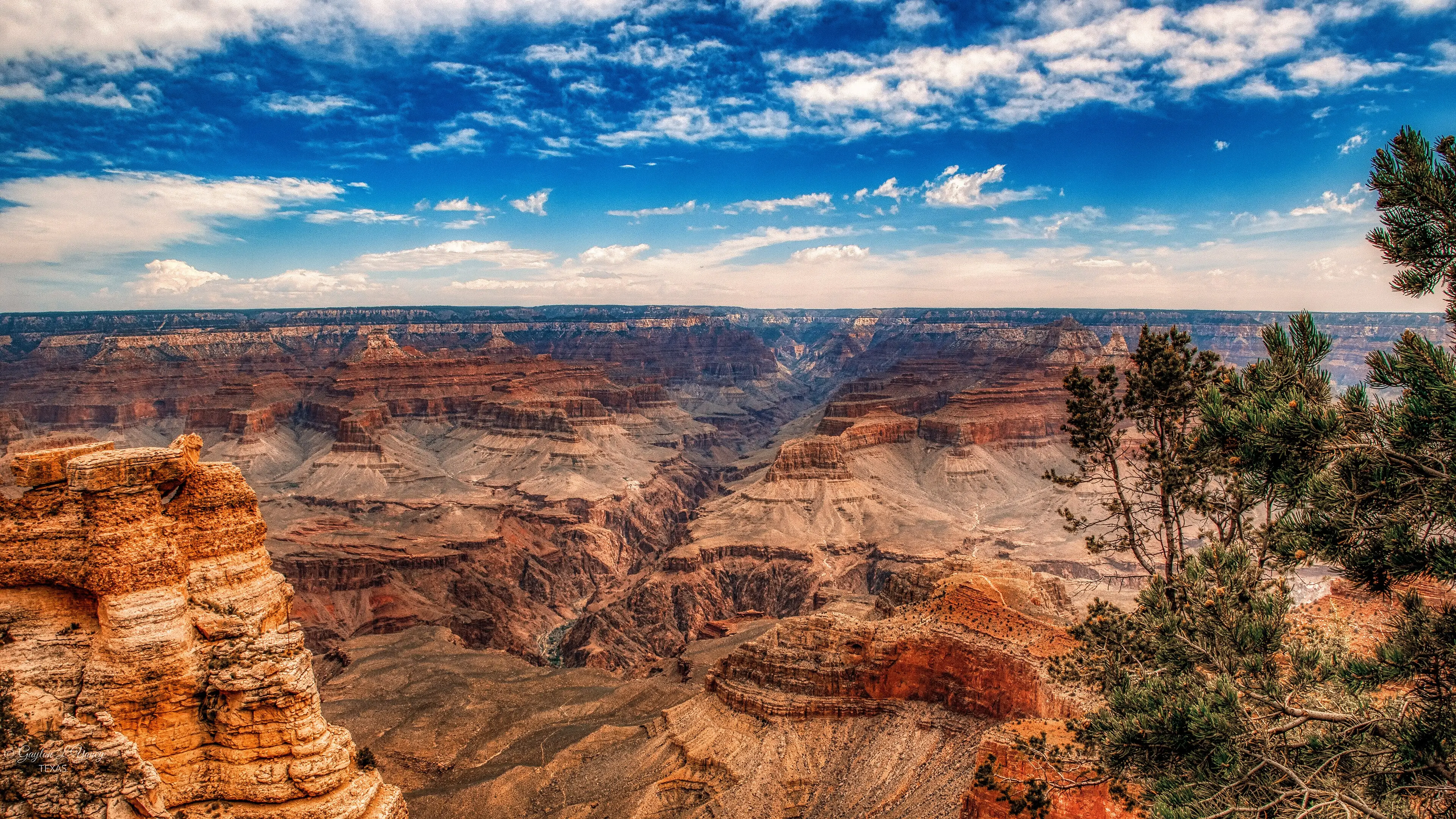
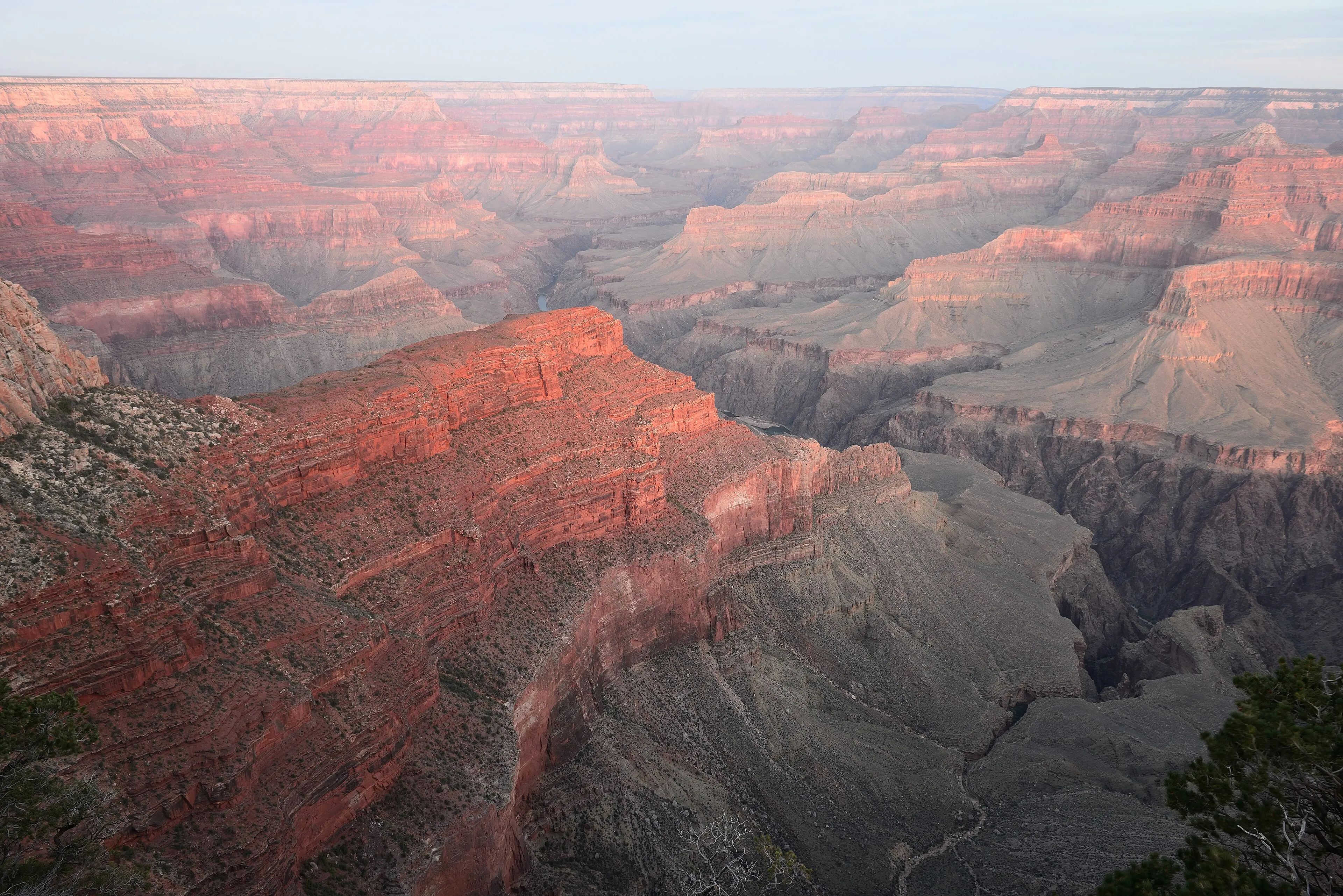
Most landscapes hide their history. The Grand Canyon shows its working. The Colorado River has spent roughly six million years cutting down through the land, and in doing so it has exposed a stack of nearly horizontal rock layers that UNESCO describes as a record of some two billion years of geological time. Stand at a South Rim viewpoint and the bands of red, cream and grey below you are, quite literally, chapters.
The numbers are hard to hold in your head. The gorge runs for about 445 kilometres, drops roughly a mile to the river, and swings between a few hundred metres and 30 kilometres wide. Distance plays tricks here: the rims sit only about ten miles apart on average, yet the road between the two visitor villages is 215 miles long.
A canyon of climates
Depth changes everything. The National Park Service notes that the South Rim sits at around 7,000 feet, high enough that walking feels harder than it should. Descend toward the river and you travel through climates as much as through rock — UNESCO counts five of North America’s seven life zones inside the park. That is also why the inner canyon is dangerous in summer, when highs often average above 105 °F.
South Rim or North Rim?
The South Rim is the canyon most people see. It is open around the clock all year, has year-round services, and is linked by free shuttle buses in the Grand Canyon Village area. The North Rim is remote and seasonal; in 2026 it opened from May 15 to October 15, and the North Kaibab Trail stayed closed after an August flash flood. Always check current conditions before planning a hike below the rim.
Planning notes
Spring break and summer bring traffic and parking pressure to the South Rim. The National Park Service identifies November to February as the least crowded period, with the caveat that winter weather can shape — or upend — a visit. Rim-to-rim is an overnight undertaking for most hikers, not a day trip. We don’t list entrance fees here; check the official park website before you go.
Verified practical notes
- Rim to rim by road: The average distance across the canyon is 10 miles (16 km), but the drive between South Rim Village and North Rim Village is 215 miles (346 km), about 5 hours (U.S. National Park Service, checked 2026-10-16)
- Altitude: The South Rim averages 7,000 ft (2,134 m) above sea level; walking can be strenuous, especially for visitors with heart or respiratory conditions (U.S. National Park Service, checked 2026-10-16)
- Inner-canyon heat: The 21-mile rim-to-rim hike is an overnight trip for most people; in summer, inner-canyon highs often average over 105 °F (40 °C) (U.S. National Park Service, checked 2026-10-16)
- Getting around: A free shuttle bus system runs on the South Rim in the Grand Canyon Village area (U.S. National Park Service, checked 2026-10-16)
When to go
- South Rim: Open 24 hours a day, 365 days a year, with year-round visitor services; lodging and campground reservations are strongly recommended in spring, summer and fall (U.S. National Park Service)
- Quietest months: November through February is the least crowded time, but winter weather is a major consideration (U.S. National Park Service)
- North Rim (2026): Open for the season May 15 – October 15, 2026; the entire North Kaibab Trail remained closed after flash-flood damage on August 29, 2026 (U.S. National Park Service)
Share this place
Sources
- UNESCO World Heritage Centre — Grand Canyon National Park — accessed 2026-10-16
- U.S. National Park Service — Grand Canyon basic information — accessed 2026-10-16
Last verified 2026-10-16 · Written by WonderAtlas Editors. Original editorial text; no first-hand visit is claimed. How we work.