Why it’s extraordinary
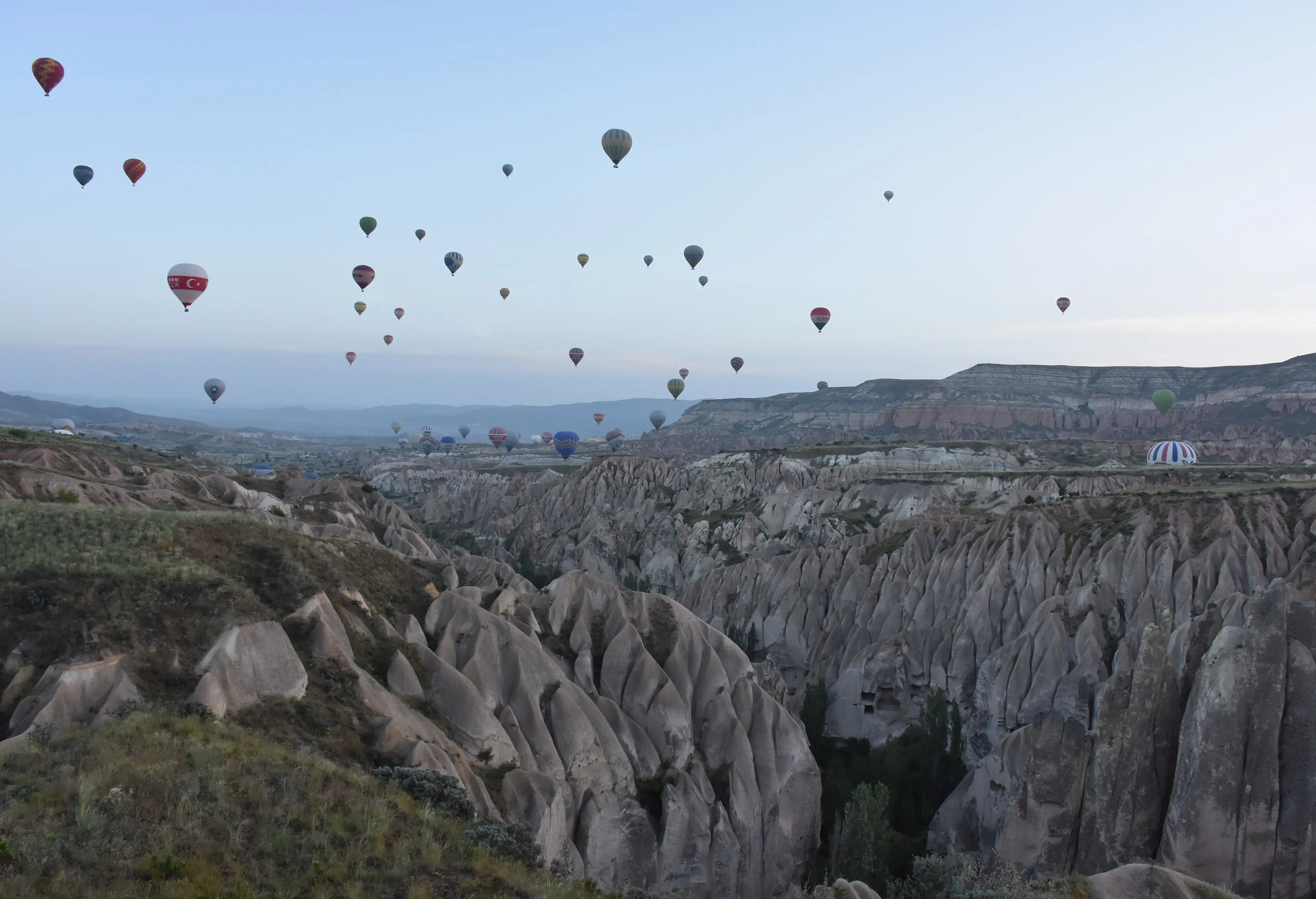
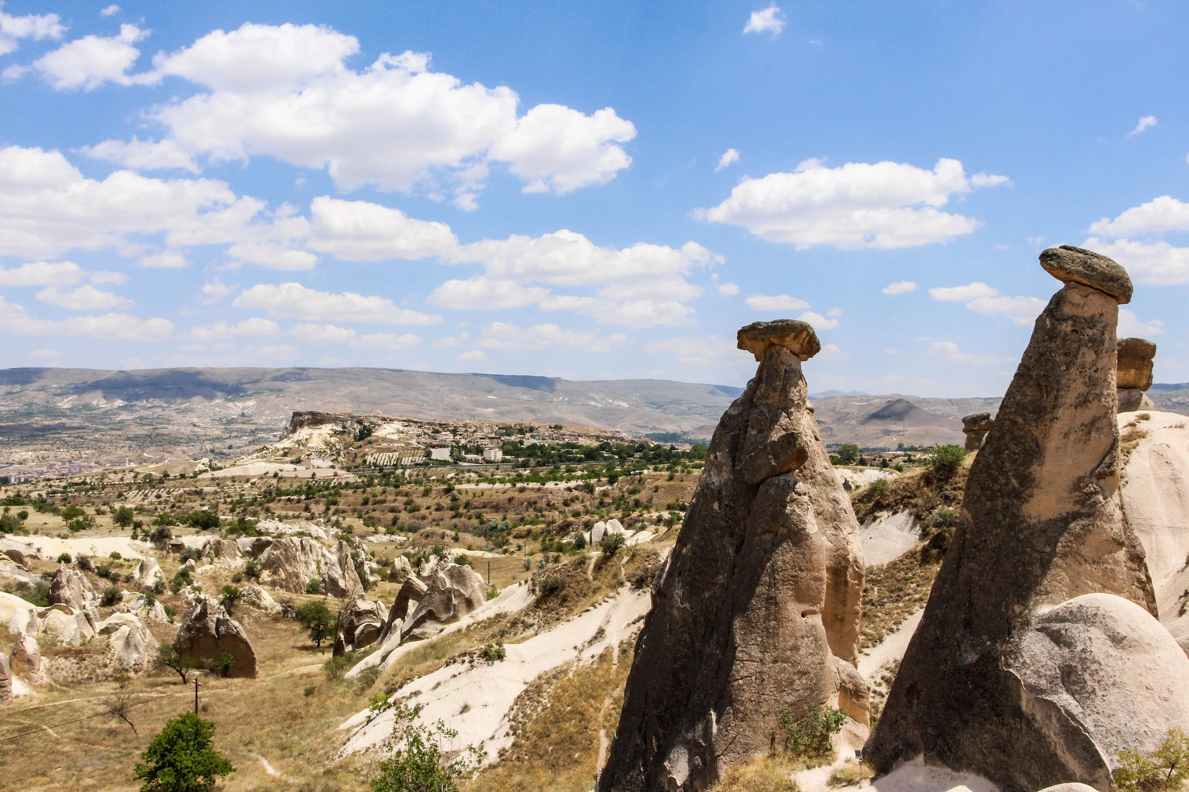
Cappadocia is what happens when a volcanic landscape and people both refuse to stay still. The plateau is a volcanic landscape, ringed by extinct volcanoes, that erosion has sculpted into ridges, valleys and the cone-topped pillars known as fairy chimneys. For more than a millennium, people carved back — hollowing out cells, chapels, whole villages and, below ground, entire refuges.
UNESCO describes the result as one of the world’s most striking and largest cave-dwelling complexes. The density is the point: you are not looking at a single cave church, but at a landscape where the line between natural formation and human architecture is often impossible to draw.
Art inside the rock
From around the 4th century, small monastic communities began living in rock-hewn cells here. After the end of the Byzantine Iconoclast period in 842, many new churches were dug and painted with richly coloured figurative scenes. That is why UNESCO treats the Göreme Valley’s sanctuaries as a leading example of post-iconoclastic Byzantine art. Names worth knowing before you go: Tokalı and El Nazar (10th century), St Barbara and Saklı (11th century), and Elmalı and Karanlık (late 12th to early 13th century).
Beneath the surface
Kaymaklı and Derinkuyu are among the subterranean towns included in the World Heritage property. UNESCO notes that communities banded together in places like these as refuges in turbulent periods — a reminder that Cappadocia’s underground architecture was a survival strategy before it was a sight.
A fragile landscape
UNESCO lists the region as an example of a traditional settlement made vulnerable by natural erosion and, more recently, by tourism. Stay on marked paths, respect closures at painted churches, and treat the rock as the irreplaceable archive it is.
Getting your bearings
UNESCO describes the inscribed area as the region between the towns of Nevşehir, Ürgüp and Avanos, plus the separate sites of Karain, Karlık, Yeşilöz and Soğanlı and the underground cities of Kaymaklı and Derinkuyu. Thinking of Cappadocia as a cluster of sites rather than a single attraction helps when planning: the painted churches, the valleys of fairy chimneys and the underground towns are spread across the plateau.
Planning notes
Nevşehir’s official climate record is a useful guide: July and August are the warmest and driest months, spring and autumn are milder but wetter, and winters regularly drop below freezing at night. Weather-dependent activities are another matter — check with licensed operators on the day. We don’t publish prices. For museum hours and tickets, check the Ministry of Culture and Tourism’s official museum portal linked below.
Verified practical notes
- Opening hours & tickets: Check whether the site you plan to visit is listed on the Ministry of Culture and Tourism’s official museum portal, and confirm current hours and e-ticket rules there before you go (T.C. Kültür ve Turizm Bakanlığı — Müzeler, checked 2026-10-16)
When to go
- Summer (Jul–Aug): Warmest and driest months in Nevşehir: average highs about 28.5–28.7 °C and on average about 2 rainy days a month (Turkish State Meteorological Service (MGM), Nevşehir climate normals 1959–2025)
- Spring & autumn: May averages 14.5 °C and October 12.1 °C, with roughly 7–13 rainy days a month (Turkish State Meteorological Service (MGM), Nevşehir climate normals 1959–2025)
- Winter (Dec–Feb): Average lows below freezing (−3.6 °C in January); the record snow depth on file is 64 cm (Turkish State Meteorological Service (MGM), Nevşehir climate normals 1959–2025)
Share this place
Sources
- UNESCO World Heritage Centre — Göreme National Park and the Rock Sites of Cappadocia — accessed 2026-10-16
- Turkish Ministry of Culture and Tourism — museums portal — accessed 2026-10-16
- Turkish State Meteorological Service — Nevşehir climate statistics — accessed 2026-10-16
- Wikipedia — Göreme Historical National Park (coordinates only) — accessed 2026-10-16
Last verified 2026-10-16 · Written by WonderAtlas Editors. Original editorial text; no first-hand visit is claimed. How we work.